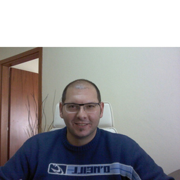
IOANNIS KOSMIDIS
Selbstständig, Land Surveyor, Ioannis Kosmidis
Eleftheroupoli, Kavala, Griechenland
Werdegang
Berufserfahrung von IOANNIS KOSMIDIS
Bis heute 16 Jahre und 1 Monat, seit Juni 2008
Land Surveyor
Ioannis Kosmidis
Ioannis Kosmidis is a freelance Land Surveyor. His main activities are: -Topographic Surveys -Boundary Surveys -Construction Surveys Equipment: -Leica total station TS02 3'' -Javad Triumph-1 GNSS receiver
1 Jahr, Juni 2009 - Mai 2010
Surveyor Engineer
OPEKEPE ''payment and control agency for guidance and guarantee community aid''
Monitoring the completion, digitalization and registration of ''AEE'' (single payment applications) Participation in field measurements (GPS) and local data collection.
9 Monate, Okt. 2008 - Juni 2009
Surveyor Engineer
GEOANALYSIS S.A.
Study for the creation of digital database of Active titles for municipality of Thessaloniki of Thessaloniki prefecture and supporting services (Phase A Cadastre study, Contract ET-08 of KTIMATOLOGIO S.A.
2 Monate, Mai 2008 - Juni 2008
Surveyor Engineer
A.U.TH. - University campground of Kalandra
Project for the topgraphic mapping of the University campground (total area of 500 acres). Establishing GPS network on the study area to support the surveying applications. Network integration in the Greek geodetic reference system (GGRS87). Design area's surveying drawing in CAD environment.
6 Monate, Okt. 2007 - März 2008
Educator
Institute of Professional Competence (IEK)
Teaching on GPS and Surveying applications
2 Monate, Juli 2006 - Aug. 2006
Surveyor Engineer assistant
AKKT
GPS and surveying applications.
2 Monate, Juli 2005 - Aug. 2005
Surveyor Engineer assistant
Alexandros Andreadis
GPS and surveying applications.
Ausbildung von IOANNIS KOSMIDIS
2 Jahre und 2 Monate, Okt. 2007 - Nov. 2009
M.Sc. in Geoinformatics at the specialization ''Modern Geodetic Applications''
Aristotle University of Thessaloniki, Faculty of Engineering
GPS analysis and applications for surveying and geodesy. Heights Systems and levelling with GPS.
5 Jahre und 10 Monate, Okt. 2001 - Juli 2007
Diploma in Rural and Surveying Engineering
Aristotle University of Thessaloniki, Faculty of Engineering
GPS theory and applications Geometric Geodesy Topographic Surveys Boundary Surveys Construction Surveys
Sprachen
Englisch
Gut
Griechisch
Muttersprache
